If you have ever taken a moment to look at any of the charts that pilots use to navigate the sky, then you have been inundated with symbols, lines, and seemingly random characters, also known as waypoints, scattered across the page.
Strategically placed waypoints, comparable to exit signs on a highway, resemble a jumbled mess of letters reminiscent of a spoon full of alphabet soup. However, every so often our friends at the Federal Aviation Administration (FAA) use a little humor while creating the maps for our aviation highways. For example, Kansas City, Missouri boasts the waypoints SPICY, BARBQ, and RIBBS, while Newark, New Jersey greets aviators with HOWYA DOOIN shortly before touchdown.
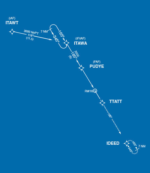
Our very own Portsmouth International Airport (PSM), is recognized amongst pilots for another bit of FAA creativity, known unofficially as the “Looney Tunes Approach.” When navigating back to our Portsmouth facilities, PlaneSense® crews are greeted with a familiar phrase from their childhood, adjusted to fit the five letter confines of the GPS waypoint. Starting from the northwest, their path takes them along: ITAWT ITAWA PUDYE TTATT IDEED. Catch it? Let’s try it again… and this time, do your best to imagine the small, yellow Tweety Bird reading over your shoulder: “I THOUGHT I SAW A PUDDY CAT… I DID!”
So, next time you hear your crew chuckle in the office up front, rest assured that it’s just the FAA putting a smile on pilots’ faces with this quirky inside joke.


